
A mission-led organization
Founded in 1895, The Wildlife Conservation Society (WCS) safeguards wildlife and wild places. It does so through science, conservation action, and inspiring people to value nature. WCS works to conserve more than two million square miles of wild places around the world. It operates 500 field conservation projects in 65 countries—and has 200 Ph.D. scientists on staff.
Many obstacles; many challenges
The non-profit sector faces compelling and challenging geospatial problems. WCS has an army of dedicated scientific staff. They also have dedicated GIS resources. But, they sometimes need more applied geospatial software development experience. This can be challenging as operational expenses at non-profits are hard to manage.
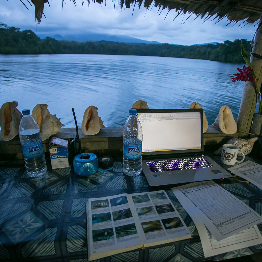
WCS needs partners who understand their work’s importance, and appreciate that funding is a constant challenge. They need periodic access to software talent. Their project needs are varied. On one project, they quantify how consumption in a location affects wildlife. On another they help re-imagine New York City’s future. On yet another, they required new data collection tools that work in connected and offline environments.
We like solving puzzles
At Sparkgeo, we like solving interesting geospatial puzzles. For WCS, we create tools and environments to share geographic research. We also assist with research that has a geographic component. Our work with WCS is varied and fascinating.
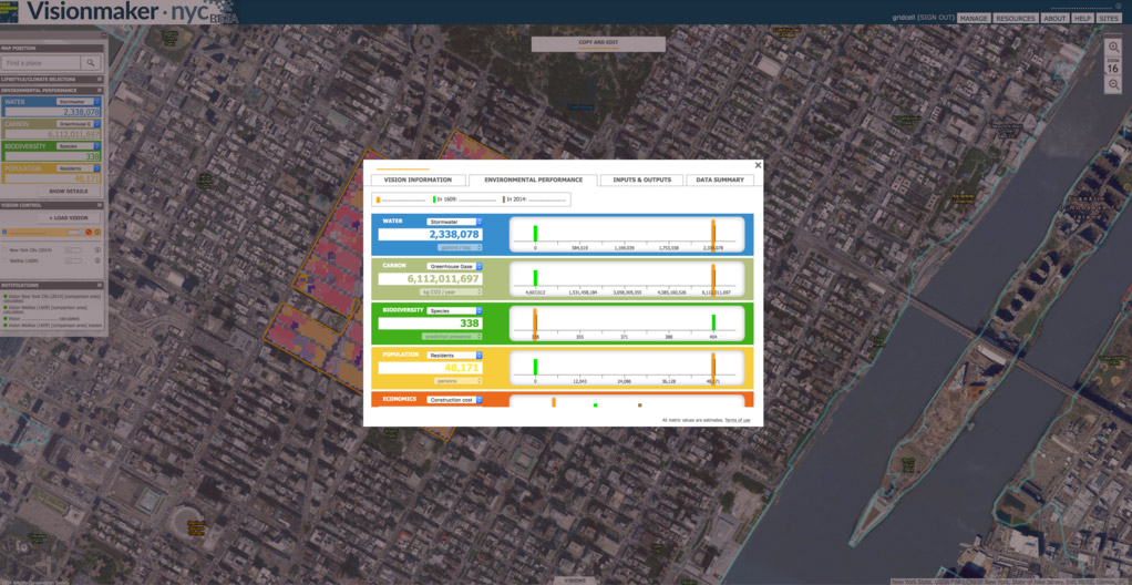
One project involved parsing complex scientific data. We then relay the findings in map form, for general web consumption. We create interactive geographic UIs, including the Horizon Impact Calculator. We helped optimize the NYC Visionmaker. We also built an offline data capture tool called MERMAID.
Good partnerships are rewarding
WCS’ mission is part of what makes our relationship with them so rewarding. We like working on meaningful global problems—and appreciate the variety of challenges. Although not-for-profit budgetary constraints can be challenging, we’ve learned how to work within them. We hope to assist with more of this important work.
“Sparkgeo is the most responsive group of spatial developers I’ve worked with. They would have been happy to deliver a single, turnkey product with relatively few requirements from me, but our complex application required a lot of collaborative problem-solving, and with Sparkgeo, every problem had an innovative solution. Whenever necessary, they created scripts and tools to tie together a set of cutting-edge, sometimes-finicky components, all in close consultation with me and with an eye on the big picture. And they’d make it seem easy.”
— Kim Fisher, Spatial Analyst and Developer at Wildlife Conservation Society