
Why geospatial technology organizations need to focus on asset data
COP26 highlighted the ever-increasing pressures being placed on financial institutions to address climate change through appropriate portfolio management, leading to an increase in sustainable investing. According to BloombergNEF, sustainable debt issuance more than double in 2021, surpassing $1.6B[1]. McKinsey is estimating that $130T will be invested in capital spending for physical assets over the next 5 years in an effort to decarbonize and renew critical infrastructure[2].
Unfortunately for investors, assessing the environmental impact and sustainability of their investments cannot reliably be determined from conventional finance reports. As such, investors are increasingly turning to alternative data sources as part of their due diligence, leading to renewed interest in geospatial data and technologies within the financial sector.
However, the availability of asset data is a key roadblock for many organizations hoping to leverage geospatial technologies for financial decision-making.
What is asset data?
The Spatial Finance Initiative defines asset data as “information about physical and non-physical assets (e.g., geolocation, asset type, capacity, productivity, age) tied to company ownership information”[3]. Asset data should include, at a minimum, the owner of the asset, where the asset is located, and what type of asset it is.
Further characterization of the asset is useful for analysis and can include physical characteristics, such as building footprint and materials, and performance characteristics, such as annual production or emissions rates. The characterization of an asset depends on the nature of the asset, creating a need to establish a taxonomy of asset types.
With a sufficiently robust asset database, analysts can prepare their assessments using a bottom-up approach that aggregates the results to a company, country, or portfolio level. Such a database would also make it easier to compare assets, companies, and portfolios that otherwise might be subject to different reporting requirements. Furthermore, analysts would be able to update their assessments in near real-time as events unfold, rather than waiting for official reports to be released.
The ‘Rosetta Stone’ between finance and geospatial
The application of geospatial technologies within the financial industry has historically been limited. One of the better examples of geospatial technologies being used within the finance sector is in insurance, particularly regarding natural catastrophe insurance. The reasoning for this is the relatively clear connection between insurance products and geospatial data:
- Insurance products frequently cover physical assets (vehicles, buildings, crops, etc.).
- The risk models for a given asset class frequently include risk factors that depend on or are correlated with the location of the asset.
By incorporating geospatial technologies into their underwriting and claims assessment processes, insurance companies can better manage their risk portfolio and maintain competitive pricing models.
However, for much of the financial sector, the connection between a financial asset and a physical asset is complicated by layers of abstraction.
For example, “What is the risk of flooding for Starbucks?” The question seems absurd at first; floods are localized, physical events while Starbucks is an abstract legal entity with a global footprint. Short of a biblical flood, you can’t flood Starbucks. The question only begins to make sense when we start to interrogate the physical assets that comprise Starbucks. For example:
- What is the risk of flooding for each of its retail stores?
- What’s the economic impact of a given store flooding?
- If we aggregate all the risks and costs, how would that impact the company, as a whole?
- How should we factor that risk profile into the company’s stock price?
As we can see from this line of questioning, we can use a bottom-up approach to our risk assessment of Starbucks that first focuses on the risk of individual assets and then aggregates those risks up to the level of the company. Likewise, we could continue that aggregation into an assessment of an investment portfolio, or for a country, or an industrial sector.
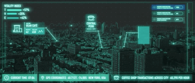
Without a connection to a physical asset, with a definable location, it’s difficult for geospatial technologies to provide any meaningful insight into such abstract financial assets. At best, we can note the region an asset is located within, and the average risk associated with that region. However, this level of assessment is likely too coarse for most applications outside of sovereign debt analysis. Thus, asset data is the ‘Rosetta Stone’ for geospatial technologies to find an application within the finance sector.
How can geospatial technologies help create better asset data?
Organizations looking to create asset databases may use a combination of internal or disclosed sources. However, these data sources can be outdated, incomplete, or difficult to access. Geospatial data can be used to fill in gaps where disclosed information is unavailable. Earth observations data sets, such as satellite imagery and topography, can be especially helpful for identifying and characterizing assets, given their low cost of acquisition and global coverage.
For example, using a combination of asset-level data and satellite imagery to estimate coal plant utilization rate, the Carbon Tracker Initiative (CTI) found that “in 2019, 41% of the existing global coal fleet could have been cashflow negative (i.e. the operating costs are greater than revenues received) based [on their] modelling methodology, despite an 8% year-on-year decline in fuel prices [4].
Geospatial technologies can also be used to monitor and validate the state of assets, often with greater transparency and timeliness than could be achieved with conventional sources.
For example, phase 2 of the Global Tailings Portal will incorporate Synthetic Aperture Radar (SAR) to remotely monitor tailings dams and to identify the large number of ‘orphaned’ tailings dams where ownership responsibility is unclear. The Investor Mining and Tailings Safety Initiative, along with the International Council on Mining and Metals, and UN Environment plans to use this information to drive a new global standard for safer management of tailings storage facilities that will improve safety and accountability in the mining industry [5].
While geospatial technologies may provide an excellent source for characterizing assets on a global scale, determining the ownership structure of those assets is a significant hurdle. The challenge is further complicated by the fact that for many companies the bulk of their environmental impact lies within their undisclosed supply chains and subsidiaries. Geospatial technologies can help to illuminate our global supply chain networks using smart tracking devices that monitor the movement of goods, a particularly useful practise for perishable goods that need to be monitored for safety reasons.
How will asset data change geospatial technologies?
As it currently stands, geospatial technologies tend to be focused on two extremes: very large-scale solutions for regional to global level challenges, or very small-scale solutions for site-specific challenges.
For example, global climate models typically only have a spatial resolution of ~100km, which isn’t sufficient for understanding the climate risks at an asset level. On the other extreme, we have the survey practices commonly used for site assessment and development projects that are often not designed to be integrated into a global framework and that are cost-prohibitive for ongoing, global asset monitoring.
Empowered by more robust asset datasets, financial institutions and other stakeholders will finally be able to make serious inquiries into the impacts and risks associated with their assets. This will, in turn, drive demand for new observational datasets and geospatial technologies tailored to meet those needs.
As geospatial professionals, we have a key role to play in helping decision-makers around the world make better-informed decisions on how to address climate change and hold bad actors accountable. One asset at a time.