
We’ve been thinking a lot about risk at Sparkgeo and how geospatial technology can support risk assessment. Context is everything when planning out investments, and geography is very good at understanding context. In an earlier post, we described COP26 and how geography can support ESGs.
The floods in Abbotsford demonstrate that while enacting policies covers how we intend to address Climate Change, more pronounced natural events will continue to happen. We need to understand these events better so that any predictive models have quality baseline data to support them.
We are at a confluence between technological ability and human desire. We can respond to extreme natural events using different data sources and data science approaches to support policy goals. And when policy goals shift, we can quickly adapt and, better yet – help form them.
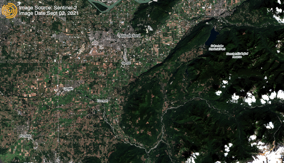
These images demonstrate before and after images of the flood in Abbotsford, British Columbia. The first image is a visual image from the Sentinel 2 sensor before the flood. The following image is a Radar image from the Sentinel 1 sensor before the flood. The following image is a Radar image after the flood. The final image is a flood mask, or where we detected water based on pixel differences and then thresholding of the pixels.
We understand the physical reality and can identify what asset-level data will be impacted by a natural event.
- What impact on logistics did this event have?
- What are the implications for future flood events, given forest fires in the summer?
To be able to answer these questions, we need context. With context, we can determine which variables contribute the most essential information. This allows us to hone in hidden solutions. In modelling terms, a sensitivity analysis.
British Columbia is a geographically exciting place. As geo-data scientists, we don’t have to look far to get quality data to validate our ideas. We can make indexes to help us quantify and qualify what goes into the definition of ESG for an organization. We can ground-truth our assumptions and ensure that the resulting approaches and results are valid for the appropriate use cases.
To quote Walter Tolber, “Everything is related to everything else, but near things are more related than distant things.”